Introduction to Orienteering +
Introduction to orienteering with P5. Finding flags and plotting on own map.Online resources about Introduction to Orienteering
Description
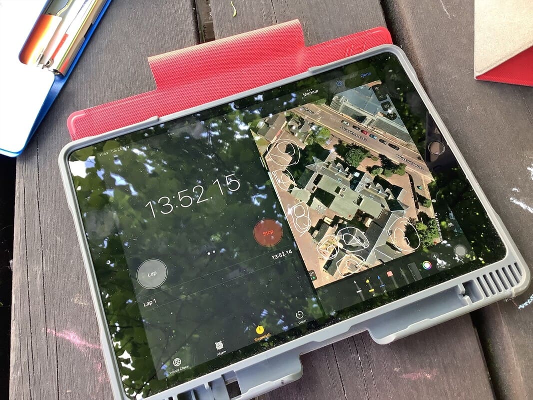
P5 have worked on a series of lessons to build up their map reading and teamwork skills. Today, in the playground, they enjoyed searching for orienteering flags and plotting the points on a digital map. Children used apple maps to screen shot a picture. Pupils then used the "mark-up" tool to plot the location of the flags.
Location details
First
Second
Health & Wellbeing
Geography
Technologies
Supporting documents
This section lists supporting documents if the group has uploaded them, such as Teacher Notes, Presentations and Risk Assessments.
Disclaimer: Whilst we hope the descriptions and risk assessments shared on this site are a useful resource, we do not endorse their suitability or completeness for your purposes.
We are not responsible for any injury or death that results from you visiting sites or carrying out activities shared in the Outdoor Learning Map: It is your responsibility to assess the risks posed by any activity you do or site you visit.
Report this post
New Search+
Want to search again for another location? Enter a postcode or place here to discover more places to explore.
View all places on mapExplore more+
Discover the outdoors and what other groups are doing in your area. Find the most visited and the latest posts, as well as news about the Outdoor Learning Map. Be involved.


City of Edinburgh Council Outdoor Learning Team – Learn more at www.experienceoutdoors.org.uk.